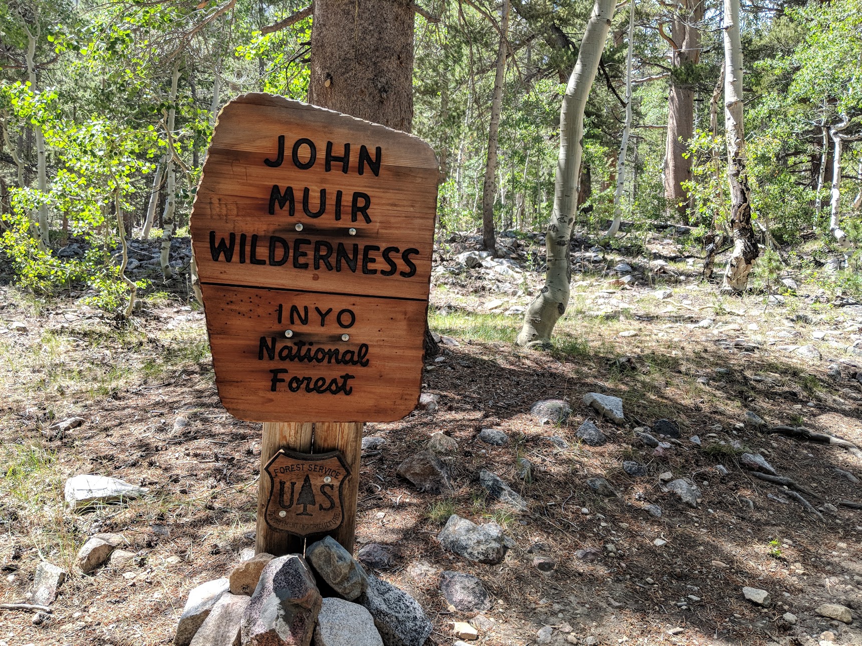
Back in early January my good friend Dave sent out an email to 20 or so people asking if anyone would be interested in doing the John Muir Trail with him. He mentioned something about going ultralight and doing it in 10 days, but I really didn’t think those were important details at the time. I had never gone backpacking for more than a long weekend, over a very short distance, but how hard could this be? I take my kids hiking in Austin all of the time. We go at least a mile or two. Of course I was in.
A couple of weeks later, I realized this was a pretty serious endeavor when Dave sent out a training regimen that had us getting up at 5am multiple times per week to run 5Ks and climb stairs up a 33-story building while wearing heavy backpacks. We “affectionately” dubbed the building Mount Windsor, after the name of the building itself.
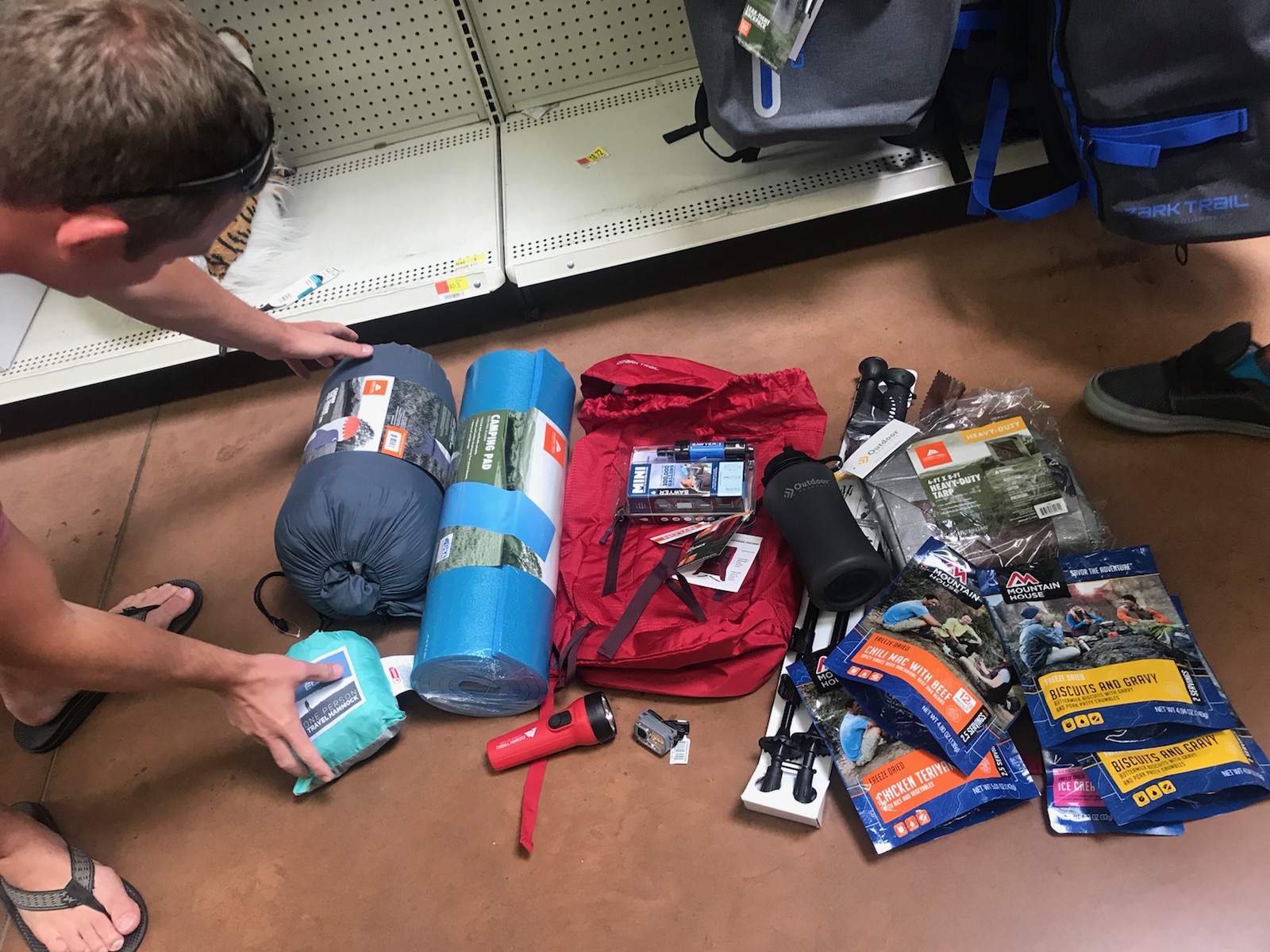
So, for basically all of 2018, I’ve been dieting, reading r/ultralight, buying gear, or training in some way, including engaging the services of both a physical therapist to work on some knee pain and a trainer at Hyde Park Gym to work on my strength and conditioning. After consuming much of my thoughts, time, and too much money over the last 8 months, I have finally backpacked the John Muir Trail (not in its entirety; more on that later).
Logistics
In the end, there were 7 of us who agreed to go: 4 flying from Austin, 1 from Houston, 1 from Dallas, and 1 from Maine. Our ringleader, Dave, applied for the permit lottery in early February, and we ended up with North-bound (NOBO) permits leaving out of Cottonwood Lakes.
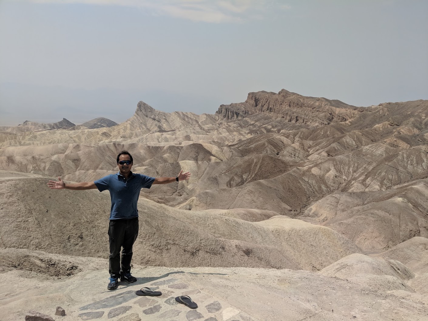
We planned to fly into Las Vegas, rent three cars, and drive to Lone Pine, California, crossing through Death Valley along the way. Joey, flying from Maine, had a conflict and could only join for the first 4 days of the trail.
Early setbacks
On the morning of Saturday, August 11th, we all arrived in Las Vegas at approximately the same time. Disaster struck almost immediately.
Eric, from Houston, did not see his bag come out at baggage claim. It was already around noon, and we needed to get to the ranger station in Lone Pine by 4:45pm in order to pick up permits. If we didn’t make the 4:45 closing time, we’d have to stick around in Lone Pine until the ranger station opened at 8am on Sunday, which meant that the soonest we could get on the trail at Cottonwood Lakes was after 9am, putting us seriously behind our aggressive schedule. Our plan had us getting in 8 miles on Saturday, not starting on Sunday after 9am. Getting an early start every morning was crucial in averaging 20+ miles per day and finishing the entire JMT in the 10 days that we intended.
After talking to Southwest, it was clear that Eric’s bag was not in Las Vegas. The earliest it could come was in a flight later in the afternoon, and even that was not assured. We decided to split up, leaving one car in LV to stick around until Eric’s bag showed up. The other two cars would try to pick up everyone’s permits before closing time. We also needed to drop off Joey’s rental car at the Taboose Pass trailhead, where he was planning on exiting the JMT.
Getting to Cottonwood Lakes
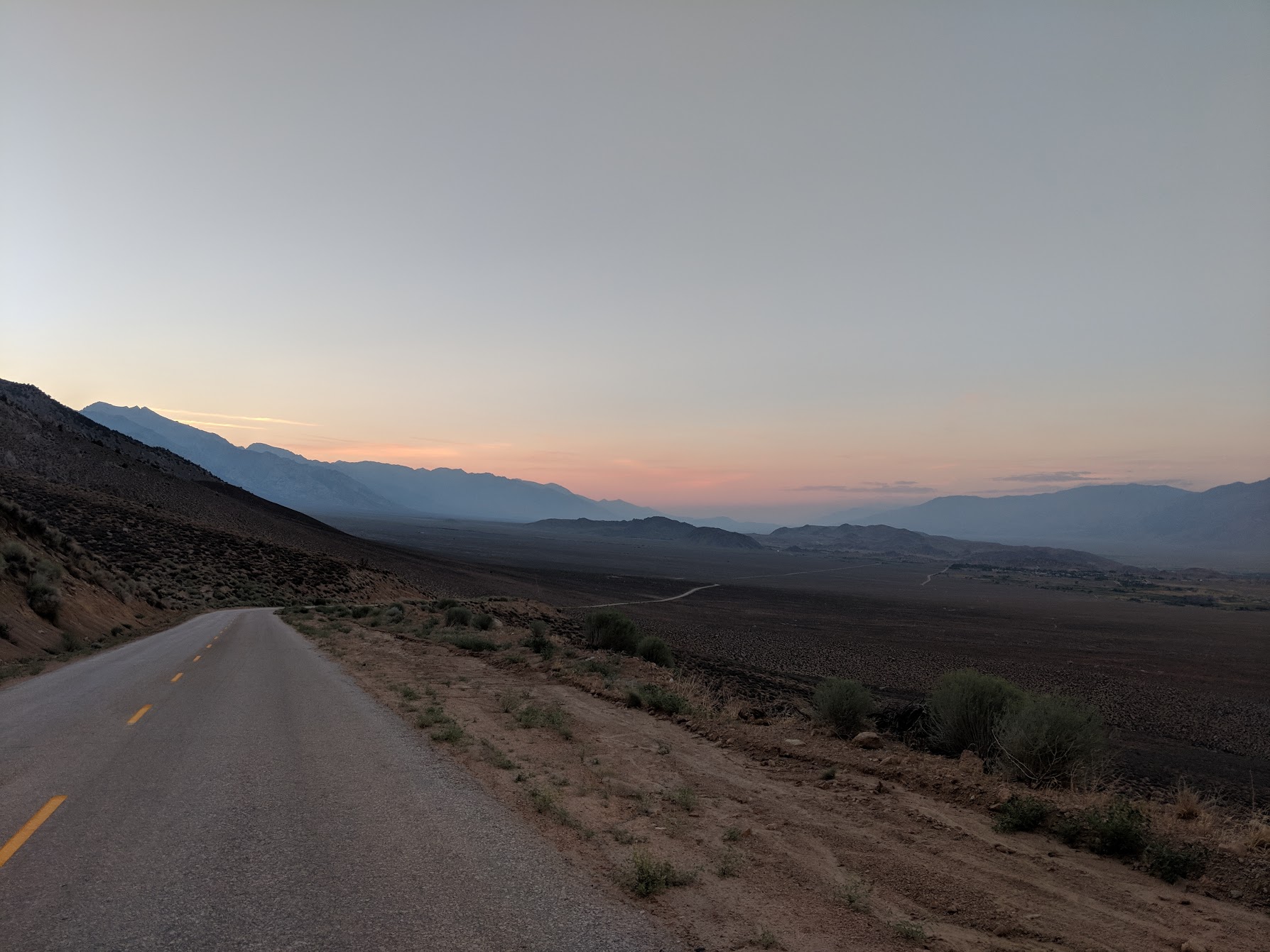
The drive through Death Valley was incredibly hot (registering 116F at one point), but the geology made for a really visually appealing drive. Even with a quick stop to experience the heat first-hand and to take some photos, we made it to the Lone Pine ranger station around 4pm - plenty of time to pick up our permits.
As we were getting permits, we got word from Las Vegas that Eric’s pack had arrived on a later flight, which was a huge relief. However, this put us sufficiently behind on our schedule that we had no choice but to spend our first night at the Cottonwood Lakes trailhead.
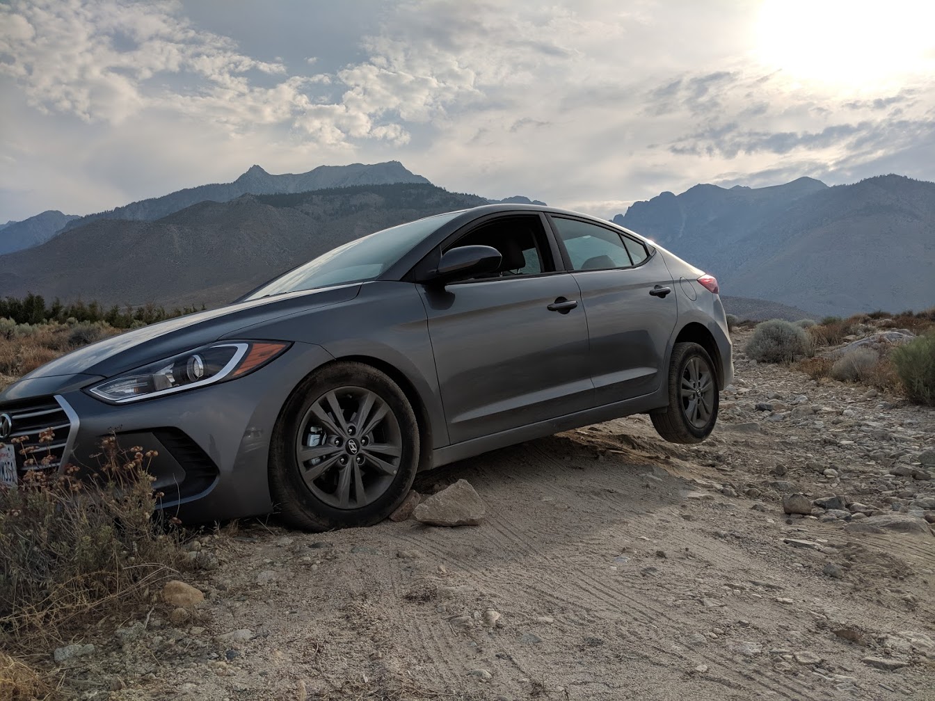
While we waited for Eric to arrive from Las Vegas, Joey and I drove to the Taboose Pass trailhead to do the car drop-off. The road from Highway 395 to the Taboose Pass trailhead was clearly intended for something higher off the ground than my Hyundai Elantra rental. The distance from the Highway 395 exit to the Taboose Pass trailhead is only 2-3 miles, but after carefully crawling along in the Elantra trying to avoid bottoming out on big rocks for over half an hour, we called it quits and found a spot to park Joey’s car along the dirt road, about a mile from the trailhead. The risk of getting a flat tire or getting the Elantra stuck on a rut or rock was too great. Well, I got stuck turning around. Fortunately, we were able to get it unstuck after cramming some rocks under the front wheels and rocking the ol’ Elantra back and forth.
Since we didn’t have time to hike at all that night, we took a “zero” day by simply having dinner in Lone Pine and didn’t get to the Cottonwood Lakes trailhead until after dark. We camped on ground sheets, cowboy style, to get an early start the next morning. As the camping gods would have it, it started drizzling at 3am, so we had a fun middle-of-the-night scramble setting up tents anyway.
Daily Journal
The following section is my day-by-day recollection of my JMT experience. If you’re considering doing your own JMT adventure, I hope you’ll find the recounting interesting and useful. At the end of each day’s section, I’ve included a link to my Strava segment with maps and elevations, as collected by my Garmin Fenix 5 watch.
Day 0 - Cottonwood Lakes to New Army Pass to Sky Blue Lake
We had a fairly late start the next morning. Since it was our first morning breaking down camp, everyone took a while to figure out their process - coffee, breakfast, order of operations packing up their gear, fitting the bear can into our pack, etc.
After at least an hour at camp, we started off with a fairly flat 2 mile warmup walk from the Cottonwood Lakes / Horseshoe Meadows campground. This turned into a gradual 2,000’ climb up New Army Pass, which we did in a little less than 3 hours.
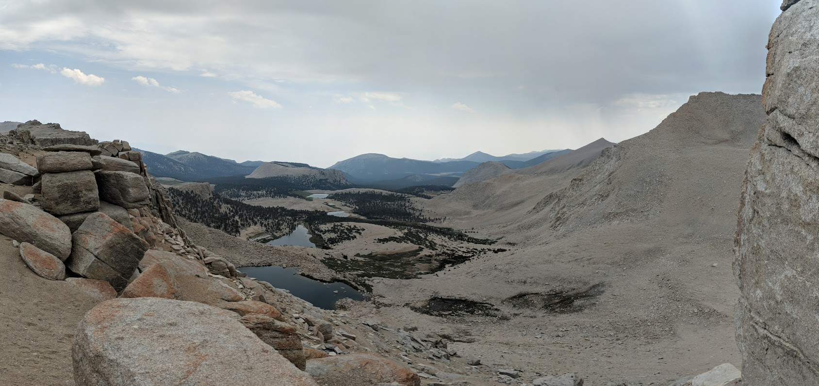
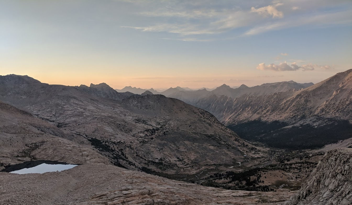
From the top of New Army Pass, we hiked another 7 miles or so and decided to camp at Sky Blue Lake.
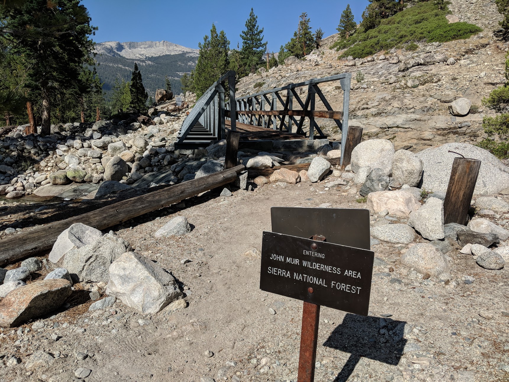
Since this was technically before Mount Whitney (the official start of the JMT), I decided to call this Day 0. It was, by far, our shortest day of hiking during the trip.
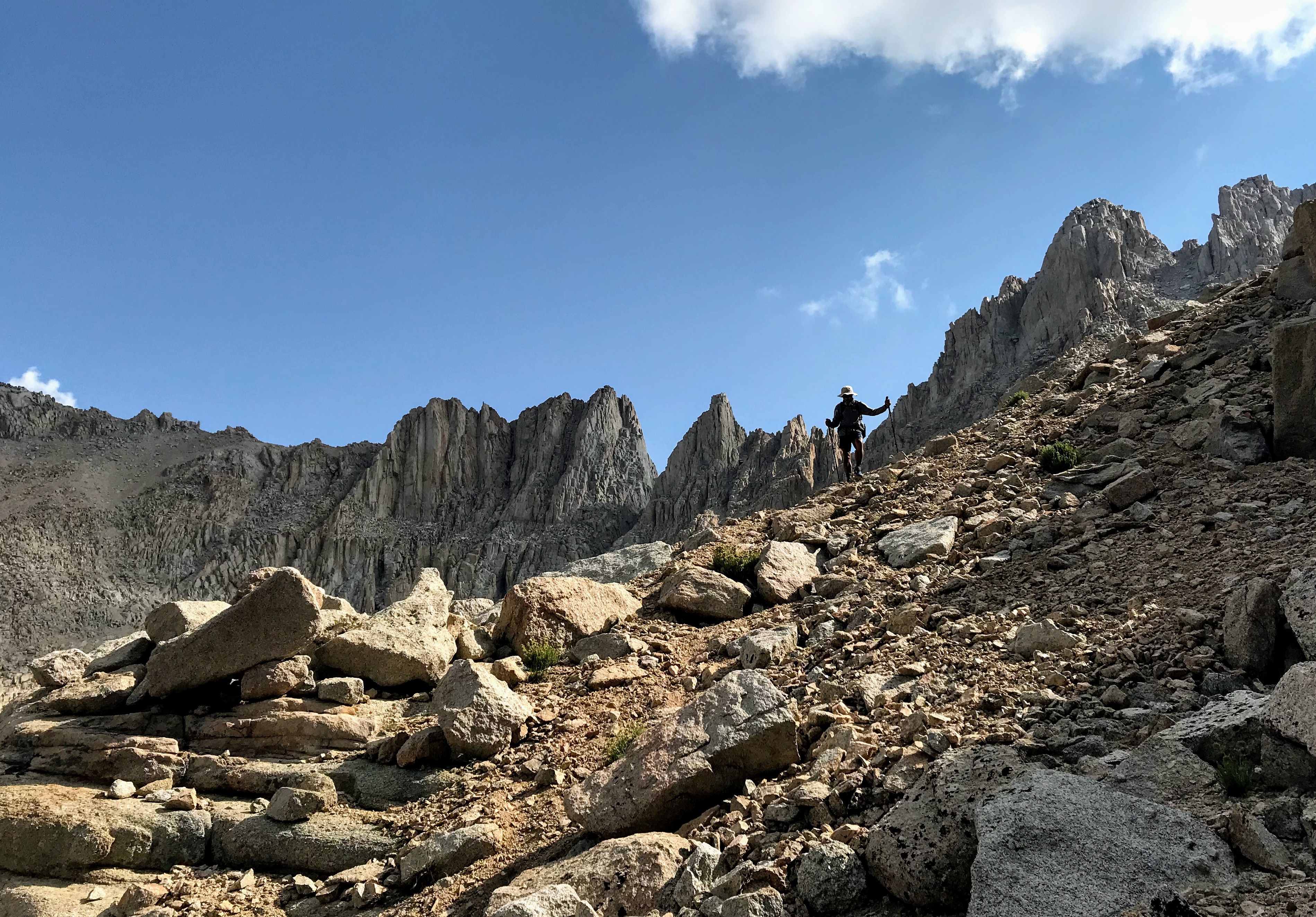
Day 1 - Crabtree Pass & Mount Whitney
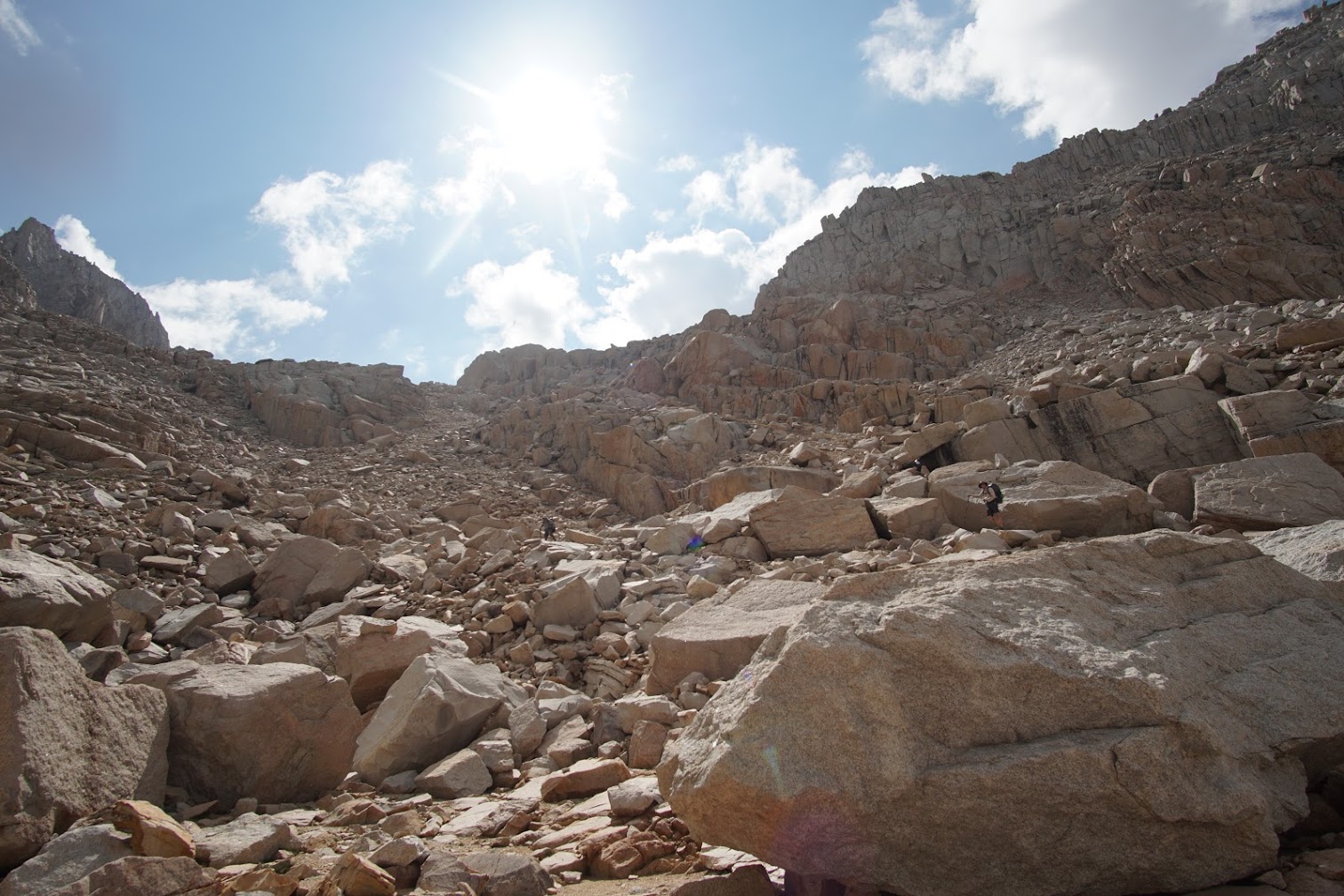
We wanted to summit Mount Whitney the next day, but there was no easy way to get to Whitney from Sky Blue Lake. Going west towards Crabtree Meadows seemed like the best option, which meant scrambling through Class 2/Class 3 rocks over Crabtree Pass.
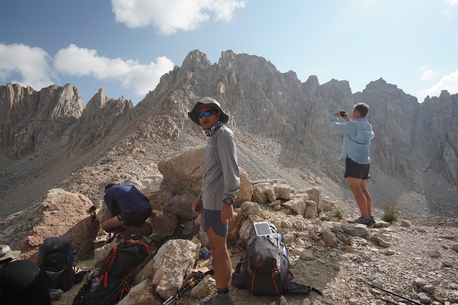
After we got up to the top of the 12,500’ pass, we realized how much of a challenge we had to get down. The north side of Crabtree Pass is no joke, and it took us about 2-3 hours of scrambling to get down to the lake (see the nearly vertical elevation graph on Strava). A misstep could have easily twisted an ankle or broken a leg. The rocks were loose, and steps would often sending you sliding down a couple of feet. We’re lucky that no one got hurt.
A few hours later, we made our way to Crabtree Meadows, where we decided to make a late afternoon Whitney attempt. By this time it was around 4:30pm, but we emptied our packs except for water, snacks, warm clothing, and headlamps, knowing full well that we wouldn’t be back until midnight at the earliest.
From Crabtree Meadows, we headed east towards Guitar Lake. By the time we arrived to the switchbacks up towards Whitney, it was already approaching 7-8pm, and the sun was starting to go down.
At this point, I wasn’t feeling particularly well, probably due to altitude, and the thought of hiking back to camp after midnight wasn’t super appealing. As the sun was disappearing over the ridge, I decided to throw in the towel on Whitney and return to camp. The group carried on. After 2-3 hours of headlamp hiking in nearly pitch darkness, I made it back to camp around 10pm. I ate dinner while watching shooting stars over the horizon, used the famous Crabtree Meadows camp toilet, and went to bed. The rest of the group staggered back well after I passed out, with a couple arriving around 1am and another two guys not getting back until 4am.
Day 2 - Forester Pass
Despite the extremely late night attempt at Whitney, we planned a long Day 2 over Forester Pass. Our alarms went off at 6am, meaning a couple of guys only had 2 hours of sleep. Fortunately, the hike From Crabtree Meadows to Forester Pass was a fairly easy climb, totalling 3,675’ over 14 miles and 6 hours.
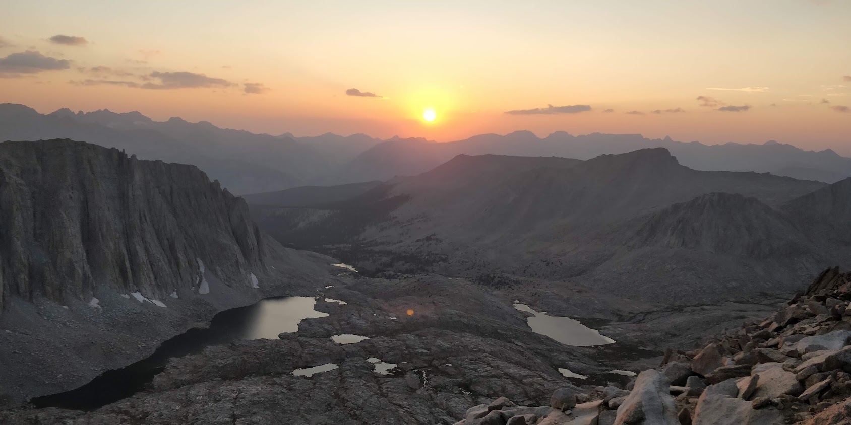
The north side of Forester Pass has some spectacular views of the valley below. We took photos from the pass and started our descent as the sun was going down over the Sierras. By the time we got down into the valley it was completely dark, and we didn’t a great place to camp. We hiked another 5 miles using headlamps before finding a flat place to camp, somewhere along Bubbs Creek.
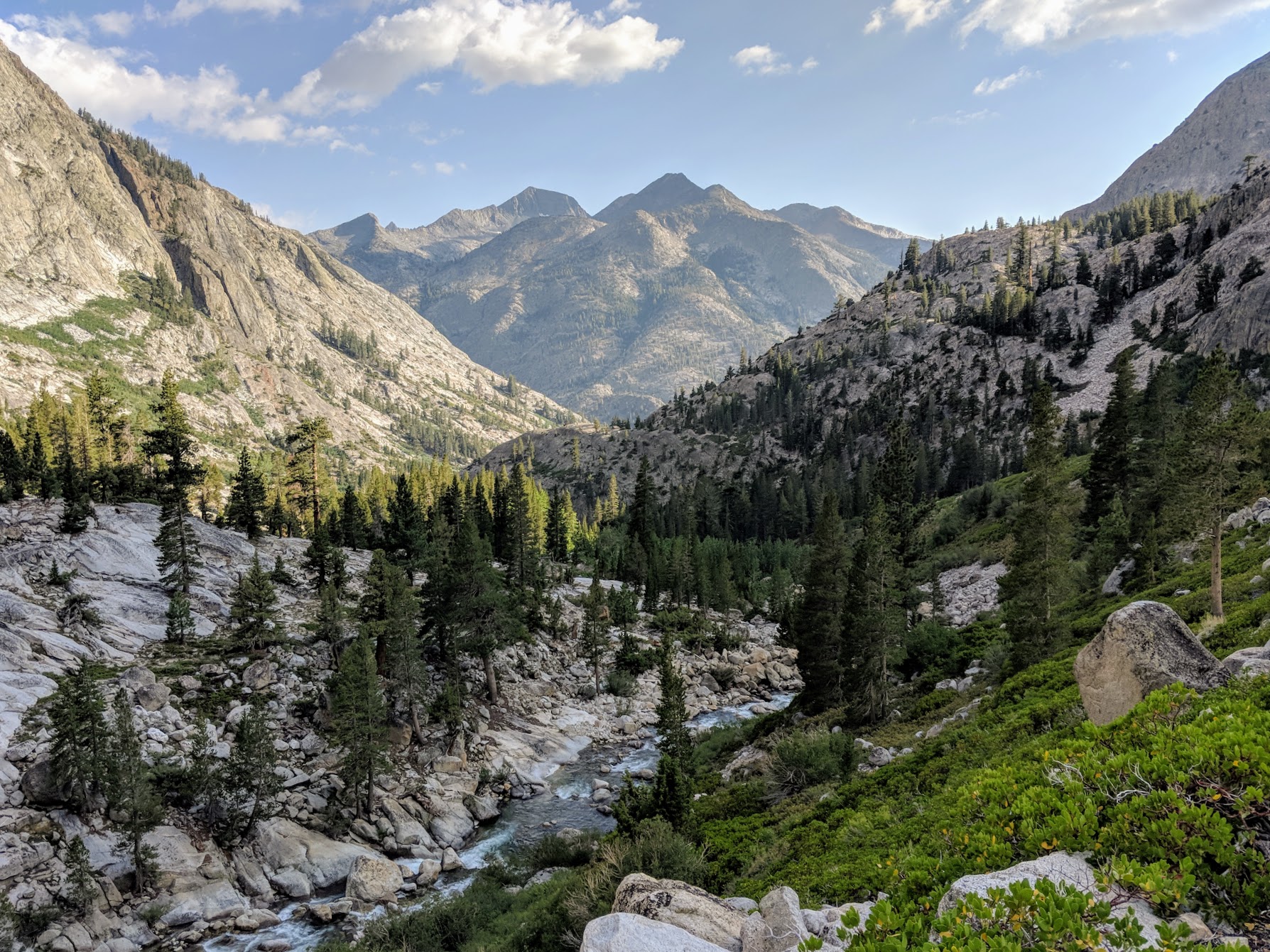
Day 3 - Glen Pass & Pinchot Pass
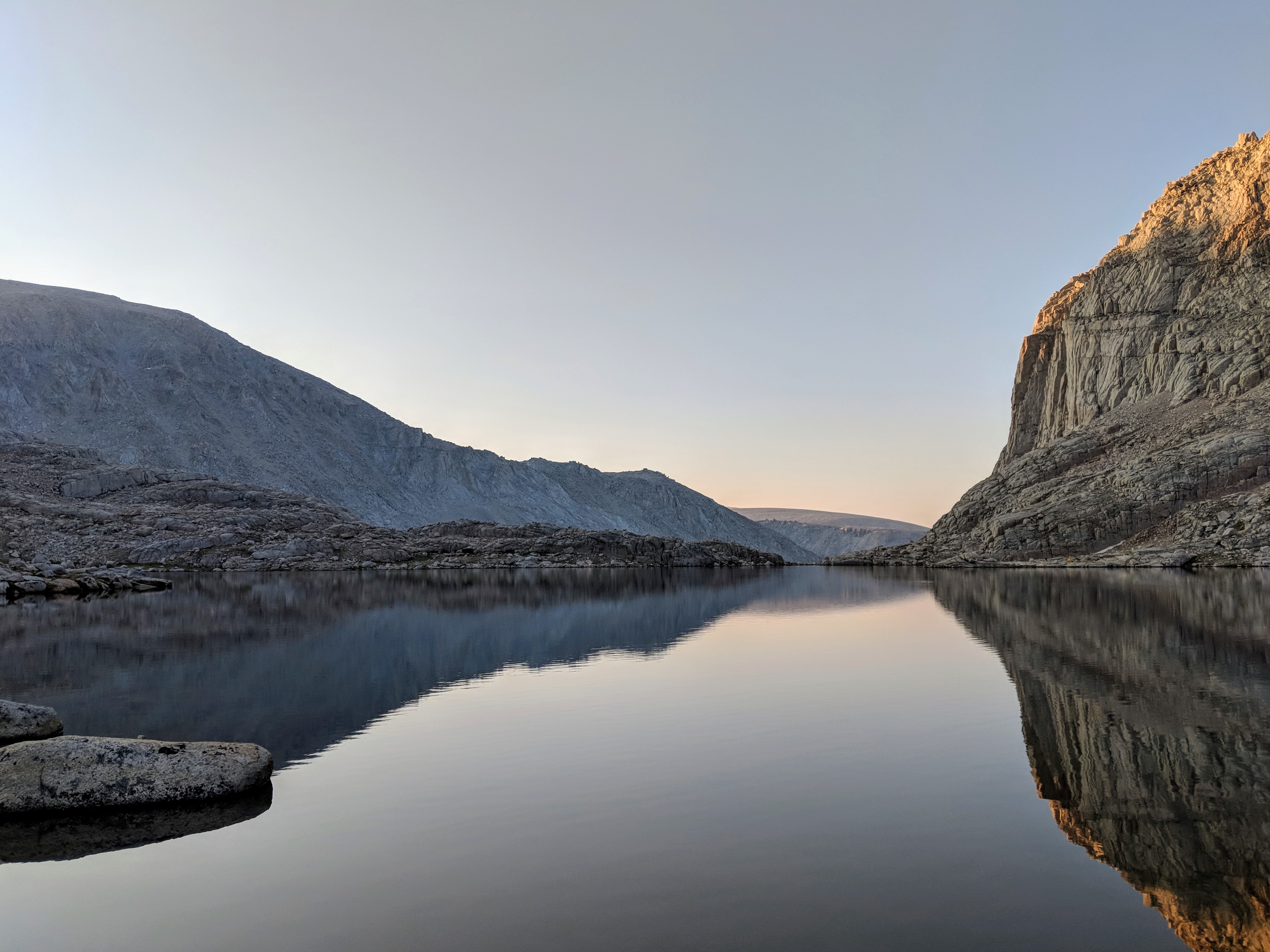
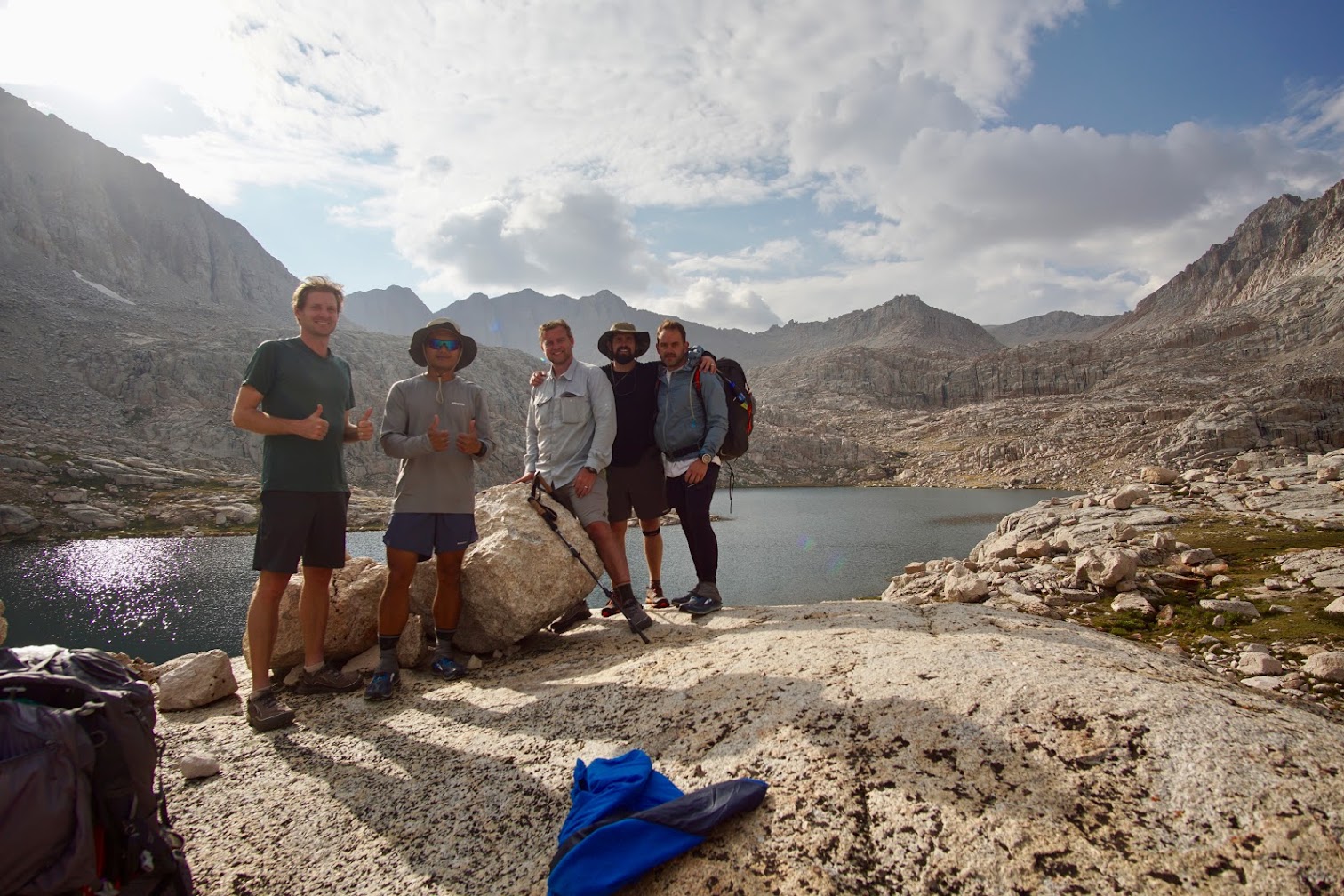
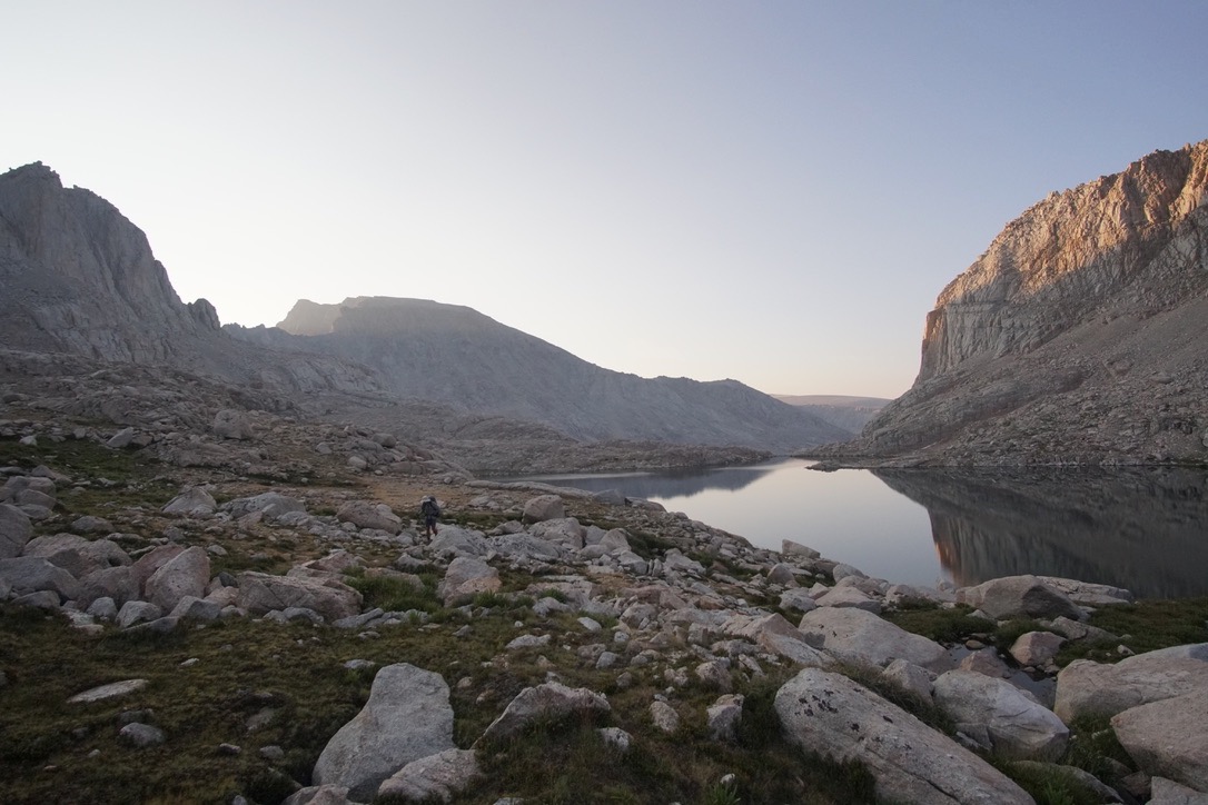
Day 3 was another tough day. Most people do 10-14 miles or a single pass in a day, but we continued on our tradition of setting the alarm for 5am and doing 20+ miles and 2 passes, which meant hiking well after the sun goes down. Day 3 included doing both Glen and Pinchot Pass. We walked more than 25 miles while climbing almost 6,500’ over 15 hours. I was beat. On the plus side, camping at Lake Marjorie was quite nice.
Walking over the Woods Creek Suspension Bridge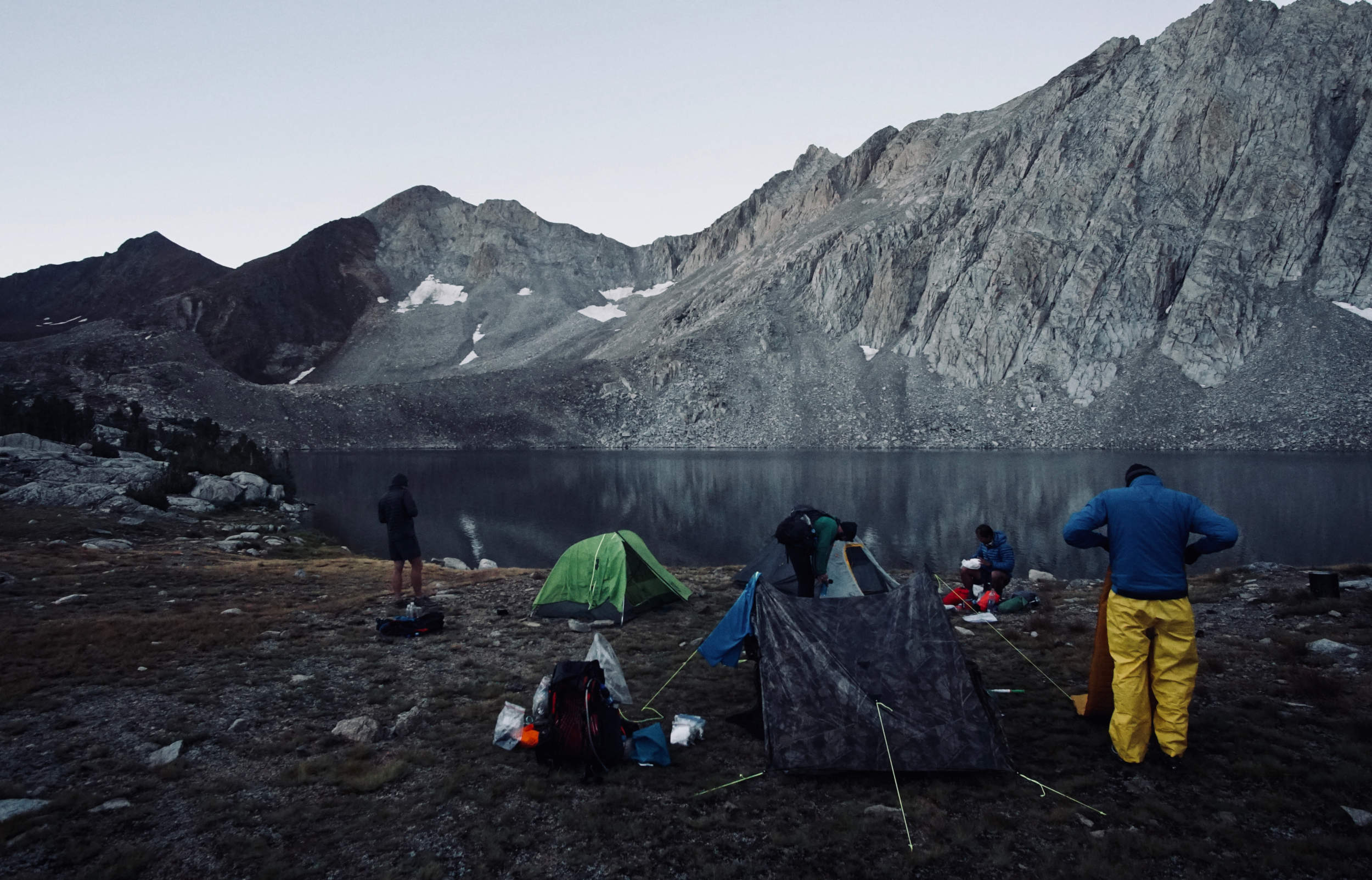
Day 4 - Mather Pass
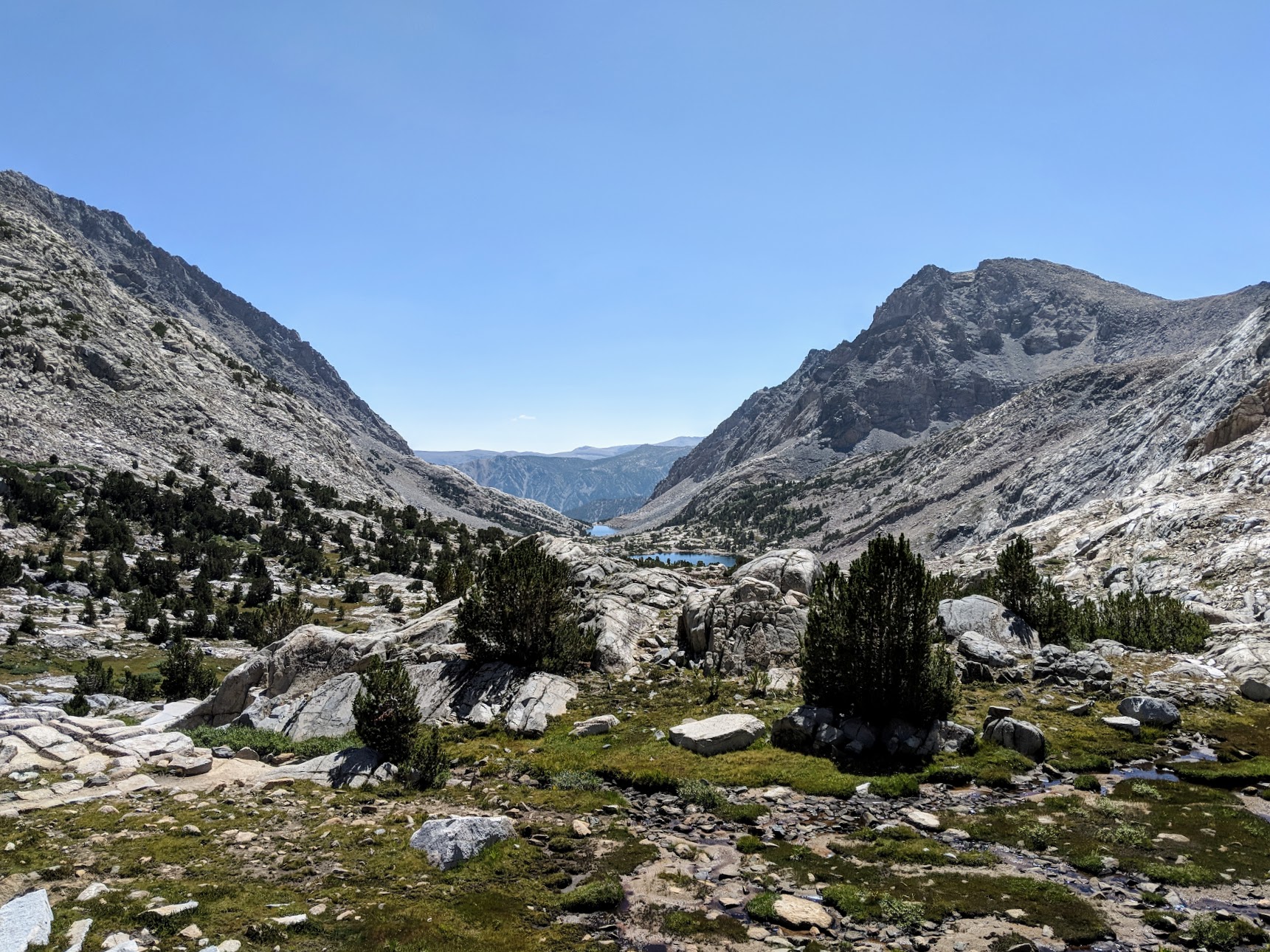
This may have been my favorite day on the trail. After falling 30 minutes behind my group, I spent most of the day hiking solo. But the weather was perfect, so I didn’t bother trying to catch up. Instead, I took a nice comfortable pace that allowed me to really soak in the beautiful high Sierra scenery. I made a few videos to try to capture the feeling of hiking the JMT:
So many water crossings Sounds of the JMT Mentally preparing to go over Mather Pass
Having a nice break on the JMT
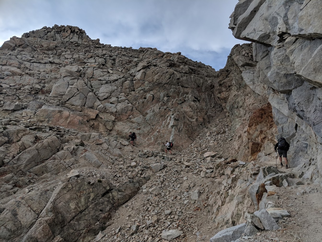
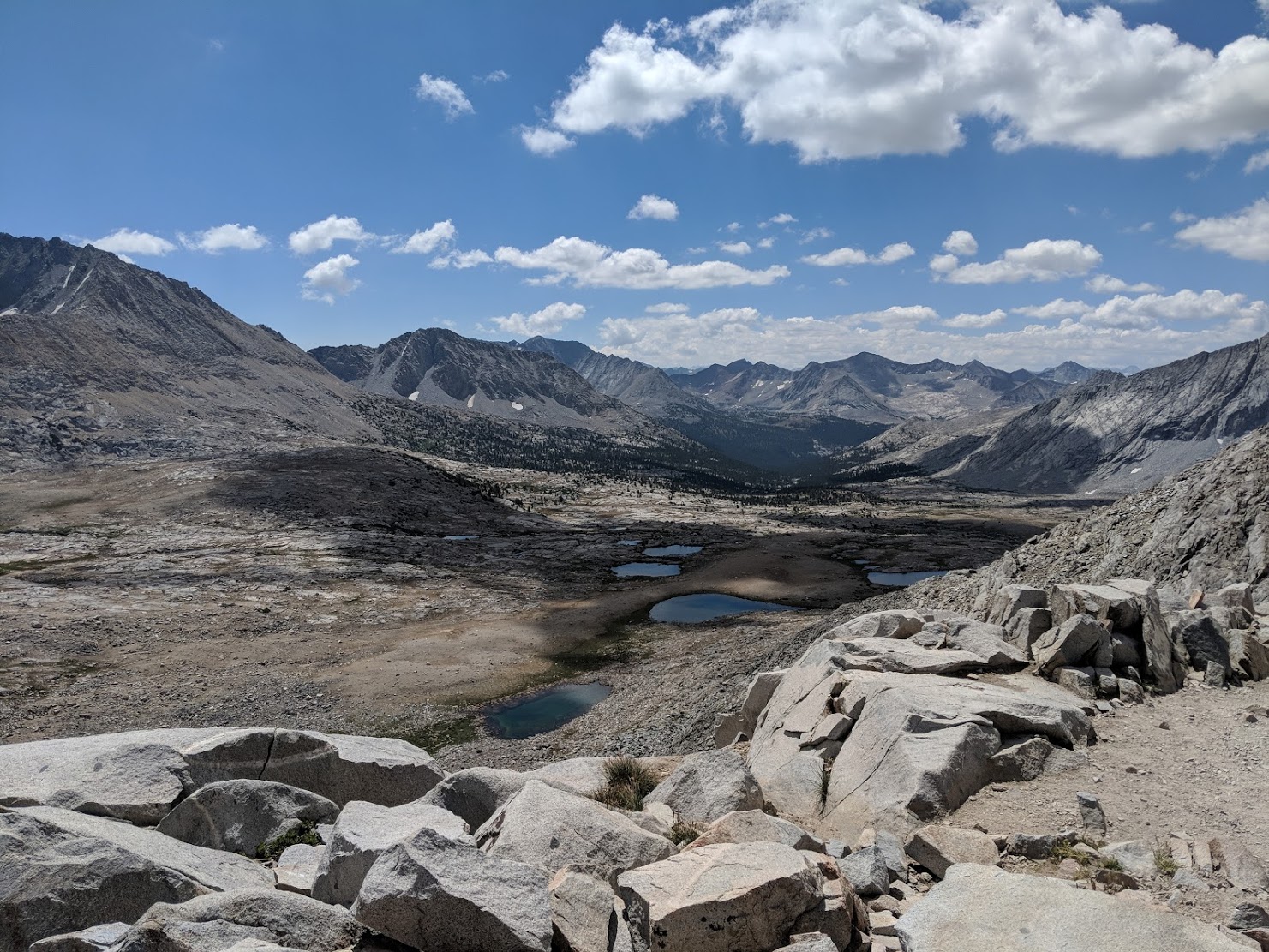
Going NOBO across Mather Pass was fairly straight forward - a climb of around 2,000’ over 6 miles to reach the top of the pass. Descending on the north side was quite a bit harder than the ascent on the south side (I imagine ascending the North side is just as hard for those going SOBO). Of particular difficulty is the Golden Staircase, part of the north side’s 4,000’ descent over 12 miles. The Golden Staircase is mostly big steps & boulders, which means your legs take an unrelenting pounding. Going down this section was where my knees really started bothering me, and my left foot started developing a blister, right in the middle of my forefoot. I sat down to tape my feet up, but cursed myself when I realized I had lent it out a few weeks back without re-supplying.
I found my group that night camped somewhere around Little Pete Meadow, at around mile 24 of the day.
My left knee was throbbing with every step, and I had a painful blister on the ball of my left foot.
I stretched and rolled out my IT band (with a nalgene) as best as I could, but I knew the following
day was going to be particularly hard.
Day 5 - Muir Pass
The alarm went off at 4am on Day 5. We were still 30 miles from the Muir Trail Ranch, where our first re-supply bucket was waiting. There was no chance we’d make it there by the 5pm closing time today, but the group wanted to get and camp somewhere close by so that we’d be able to pick up our re-supply when MTR opened at 8am the following morning (and enjoy “sleeping in”). Otherwise we’d have to get up early and hike the remaining miles to MTR to make it by 8am.
We quickly broke camp, and everyone except for Ryan was ready to go by 5am. Ryan had dropped his Leatherman CX somewhere at camp and was still looking for it when the rest of us started our hike for the day. When the sun came up, the five of us had already covered 4-5 miles.
My blister was still bothering me, but my knees felt slightly better. After a few miles, however, I hit a energy wall and couldn’t keep up with the group. I told them to go ahead and that I’d meet up later. This was fine with me, as I learned that I enjoyed hiking solo. As the morning wore on, though, my energy levels continued to drop while my knee pain increased. I was spent by the time I got to the base of Muir Pass. Each step up the pass was a challenge, and I needed to stop for a breather every few hundred feet. It was a baffling malaise that I couldn’t quite shake.
If I didn’t get it in gear, my chances of meeting up with the rest of my group were slim. No one was quite sure if we’d make it the entire 30 miles to MTR, so we hadn’t agreed upon a place to camp. Without any way of communicating with my group, I’d be forced to hike solo and hope that I’d find the group campsite later that night, somewhere along the trail, in the dark. The chances of that were slim. And if I didn’t catch up with them that night, I would have to get up early and hope to catch up with them at MTR. And if I didn’t catch up with them at MTR, I knew it would be even harder and harder to catch up with them at all. I had to catch up with my group in order to make the pre-arranged shuttle pickup at Yosemite Valley on Day 10. As this calculation swirled in my head, I was feeling worse as I forced my body up Muir Pass. Then I noticed that my pack’s hip-belt had started to rip and separate from the rest of my pack.
The combination of my hurting knees, blisters, fatigue, the logistics of hiking solo, and equipment failure - it seemed all too daunting at the time. I decided that I wanted to exit the JMT.
Ryan caught up with me on Muir Pass a little while later. He was a fast hiker and would easily catch up with the rest of the group. I told Ryan that I was bailing out and to inform the rest of the group, since I had no other way of sending a message to the rest of the group. We said our goodbyes, and Ryan walked on while I continued to trudge slowly up Muir Pass. There was no way for me to change my mind now.
The rest of the day was my hardest on the JMT. From the top of Muir Pass, I made it another 14 miles (about 7 miles shy of MTR), before making camp at Evolution Meadow around 8pm. I camped next to a wonderful couple from Seattle who gave me some fig newtons and delicious Trader Joe’s ginger cookies, which was out-of-this world good, since I had been eating keto for weeks.
Day 6 - Muir Trail Ranch & Piute Pass
The next morning, I wanted to get to MTR to talk to them about exit options. My hope was to go west via the Florence Lake ferry and somehow make it back to Lone Pine. I thought I only had about 7 miles to MTR, but I miscalculated and had to hike 10 miles to MTR.
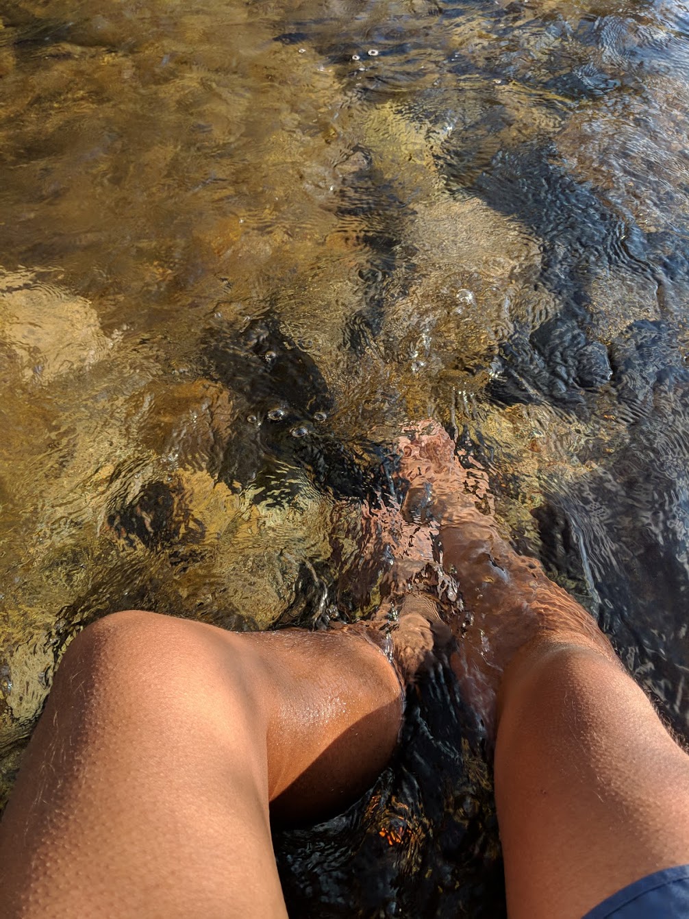
It was 10-11am by the time I got to the MTR area. I had heard that the hot-spring at MTR were worth a visit, so I sought out the hot-spring before going down into the Ranch. That required walking another mile or so, fording a river, and then walking across a meadow. The hot-spring itself was basically a hot muddy pit and was pretty underwhelming. Having hobbled all of this extra way to get there, I went ahead and got into the warm, muddy water. I had enough of the experience after 5 minutes, but what made the stop worth it was fording the river on the way back. The fast-flowing river water was cold and crisp, especially after the hot spring, so I decided to just plop myself in the river and soak in the cold for a while. It felt fantastic.
The kind folks at MTR told me that I could exit the JMT west-bound via Florence Lake and hitch-hike towards Fresno, but then my public transportation options from Fresno back to Lone Pine would probably be a 2-day trip involving multiple Greyhounds and other transit systems. This seemed very unattractive.
The other option was to hike out east-bound via Piute Pass, requiring a 5 mile backtrack to where the JMT met up with the Piute Pass trail. From this junction, Piute Pass itself was a 3300’ climb over a distance of 20 miles to the Piute Pass Trailhead. From there, I’d still be 30 miles by road to the town of Bishop, and then I’d have to hitch-hike 60 miles to Lone Pine. And from Lone Pine, I still had to figure out how to get up to my rental car at Cottonwood Lakes. After walking for a week in one direction, I suppose you’re pretty far from where you started.
Both the west-bound and the east-bound options seemed bad, but after some hemming and hawing, I decided that a punishing hike to the East would ultimately be faster than going West to Fresno and navigating public transportation.
I backtracked to the JMT/Piute Pass intersection and hiked as much as I could of Piute Pass before setting up camp that evening. Fortunately, the weather was perfect, and it turned out to be a beautiful way to enjoy my last night on the trail.
Day 7 - Piute Pass to Trailhead
It was a bitter-sweet morning. I couldn’t help but feel a tinge of disappointment, knowing it was my last day on the trail. Months of training and thinking about the JMT were coming to an end. As I packed up my gear for the last time, I was overjoyed about the thought of seeing my family soon. However, I also wondered where my group was and how everyone was feeling, lamenting somewhat my decision to bail. I also thought about the logistics of hiking out and how I was going to get to my car, over 100 miles away.
After a slow breakfast, I headed towards civilization.
The Piute Pass trail was a very scenic route, but for me it was a tough hike out. My JMT maps didn’t include Piute Pass, so I wasn’t quite sure where I was or how much further I had to go. This probably contributed to how long it felt, but after what seemed like a very long day, I made it to the Piute Pass trail-head in the early afternoon.
There were lots of people at the Piute Pass trailhead. Within a few minutes of holding my thumb up, I was picked up by a friendly woman heading towards Bishop. She dropped me off right across from a McDonald’s, so I went in to have a quick wash up. I also couldn’t resist temptation and ate a Big Mac.
I did some research on my phone and learned that I would have to wait until the next morning for a bus to Lone Pine. I wanted to try to get to Vegas that night, so I decided to attempt hitchhiking. After 30-45 minutes of sticking my thumb out on Main street Bishop, a climber coming from Mammoth Mountain picked me up and dropped me off in Lone Pine.
In Lone Pine, I spent another hour or so trying to hitch-hike up to my car at Cottonwood Lakes, but only one car stopped, and they were on their way to Whitney Portal. It was getting late in the day, so I gave up on hitch-hiking up to Cottonwood Lakes and walked over to the Whitney Portal Hostel to ask if they had any suggestions. They gave me a phone number and told me to ask for Kurt. The famed Lone Pine Kurt (760-876-4811) came by 15 minutes later. Kurt was super friendly and we had a great 45 minute conversation as he drove me up to my car at Cottonwood Lakes, exactly where it was parked more than a week earlier. I packed up my things and drove back to the Whitney Portal Hostel to take a $7 shower before driving to Vegas.
I was on the road to Vegas by 9pm and on a flight back home the next afternoon.
Final Thoughts
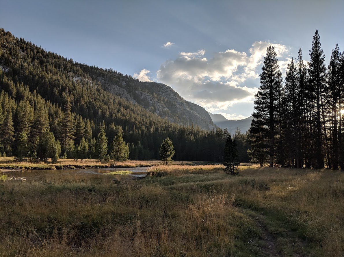
While I’m a little disappointed that I didn’t finish the JMT, I’m super happy that I made an attempt and enjoyed the experience (thanks Dave!). Hiking 165 miles over 7 days, along some of the most beautiful scenery in the world, is something I’ll never forget.
The training alone was worth it - I was probably in the best shape of my life at the start of the trip. I’m significantly more aware of my body, having learned what tends to hurt, what causes the pain, and how to deal with it. While I don’t think I quite reached my physical and mental limits, I have a general idea of what they are.
I’m a much more competent and confident backpacker. I’m no longer intimated by the idea of going on long multi-day trips. I have a much better grasp of how to train, prepare, and pack for these types of trips (I’ve already started daydreaming about the Colorado Trail, the Tahoe Rim Trail, the Pacific Northwest Trail, and even Tour du Mont Blanc).
Our planned pace of 22-25 miles per day was simply too fast. At times, it felt like a heads-down, forced-march to make miles, which didn’t leave many opportunities to simply sunbath on a rock or catch some mountain trout by a serene high Sierras lake. In hindsight, a 15-18 miles per day pace would have been ideal, and I think most of my compatriots would agree. The reality, however, is that it’s simply hard to coordinate a group of guys to walk away, literally, from our familial and work lives for 3 weeks. We had all spent a tremendous amount of time throughout the year training, and I think it’s safe to say that we were all extremely appreciative of our significant others for giving us the time to dedicate to this trip.
Since getting back to every-day life, I’ve been surprised about how much I still think about the JMT. I’m still a member of a couple of the JMT Facebook groups and /r/JMT subreddit and enjoy seeing people’s pictures and posts about their own JMT adventures.
I sometimes think that maybe I should have pushed harder and longer through the pain to finish the JMT. I don’t know. But I do know I’ll be back on the JMT again.
More photos: https://photos.app.goo.gl/WbGcfb5Zi3bjfBB37
Lighterpack: https://lighterpack.com/r/8z8oy7
Leave a comment and let me know if you’d be interested in an equipment post that goes into detail about each piece of gear that I brought along.